Natural Hazard & Social Vulnerability Risk
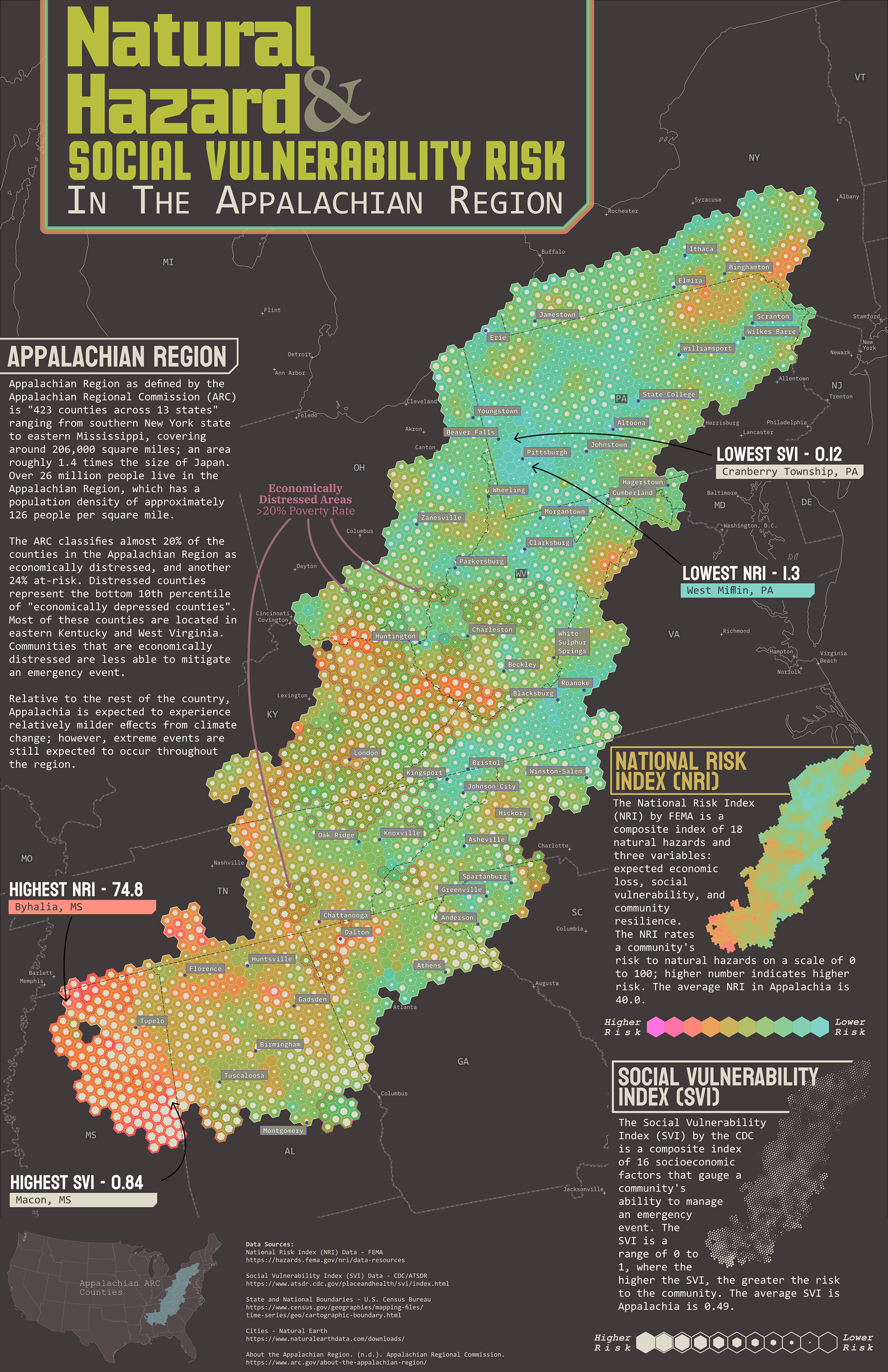
The goal of this map was to identify locations with high NRI and SVI within Appalachia. Communities with high NRI rates are more likely to experience natural hazards. And locations with high SVI rates are less likely to be able to manage emergency events.
The highest rates of NRI and SVI were in Mississippi, and the lowest rates were in southwestern PA near Pittsburg. While this variation appears to have a north/south split, it also had a rural/urban component.
Tools Used:
ArcGIS Pro
Affinity Designer