Port Fourchon Expansion and Erosion
This is a 39-year timelapse (1984-2023) of Port Fourchon in Louisiana that shows the simultaneous expansion of the port while the coastline recedes.
This was created using the StreamLit app by Dr. Qiusheng Wu.
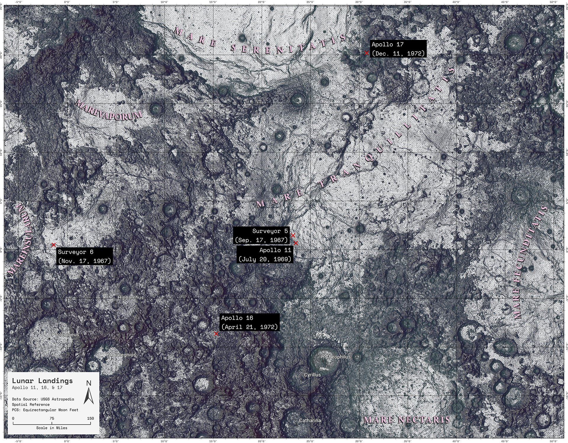
Apollo Lunar Landings
This was an interesting project for me. It was the first personal project I started in ArcGIS Pro. I had planned to enter it into the 2020 TNGIC map contest; however, COVID happened, and I barely survived my junior year in one piece.
One challenge to mapping the moon was reference points. I had no idea what I was looking at. Another was scale. I had a lot of raw elevation data that was pretty unwieldy to use, but I needed to figure out where to clip it. See the first problem as well. And finally, I needed to learn about lunar coordinate systems. Since the moon is just over a quarter the size of the earth, the coordinate system can have very dramatic effects. I was able to modify an existing coordinate system slightly for my needs.
This project largely sat on the back burner until recently. I consider this a work in progress.